The family goes down south to Disney World in Orlando every couple of years (well twice now….) we always have a good time there seeing all the sites and attractions. Also everytime I say “I wonder why there is no GPS Point Of Interest file available for download into a GPS unit”. This seems like a “natural” to me. Especially for persons having portable GPS units that want to get to an attraction in the shortest route possible from inside or outside of the park. So, I searched the internet and came up with one “Disney World POI” file… but it only has about six entries for the gates of the different theme parks… not so useful for what I want!
I decided to create my own file. No problem. Open the Magellan POI program and enter in the information that is required.
Oh, you don’t have Magellan POI File Editor software on your PC/Mac. Man, you are soooo out of luck.
It is supposed to be on the CD that came with your GPS. Being extremely lazy I did not even try to locate that CD… I just Googled until I found a link someone posted. Maybe I should be nice and add a link to let you download it from here….. we’ll see….
Magellan POI Editor UPDATE 12/14/2015 The link to the POI Editor no longer works so I have removed it. Try searching for this. Things are a lot easier now than when I originally posted the link. Not to mention the version I had posted is long out of date!

Small and portable it can be used in the car or stuck in a pocket for pedestrian use – like walking around Disney World! (Batteries are supposed to be good for 3 hours or so.)
Seems simple enough, there are only about three things: Latitude, Longitude and Name for each POI. Oh, what is that information for each of those? Where do you get it? Hmmm… maybe not quite so easy after all. Open Google Earth, pan around until you find the location, zoom in to make sure it is right, copy the info from the screen into the Magellan POI program…. sort of time consuming. Maybe not such a great idea after all, but it seems like there should be a better way to do this.
A search found a web site forum with some hints, and a reference to another web site where you can do latitude and longitude lookups using an address, name, etc. Check this out –>
UPDATE 12/14/2015 This appears to no longer be working so I removed the link but you can copy and paste to try it. “itouchmap.com/latlong.html”. One thing it does others may not, reverse lookups… if you have a latitude and longitude plug them in and see where in the world it is at. Might be good for doing a “cross reference” check on points you have.
But, this is still a rather slow, copy and paste operation. Find the location, copy the info (a piece at at time) paste it into your file, add Name/Description and go to the next place. If you have a lot of points be prepared to spend some serious mousing time. So… there has to be a better way. Google to the rescue again! An extended search for: POI +file +create and some other terms and come up with a lot of nothing…. wait what is this one…. ITN Converter…. download it, install (cool it doesn’t “really” need to install, it is an executable that runs on it’s own. Even from a USB memory stick.)
So… does it work or not?
So… does it work or not?
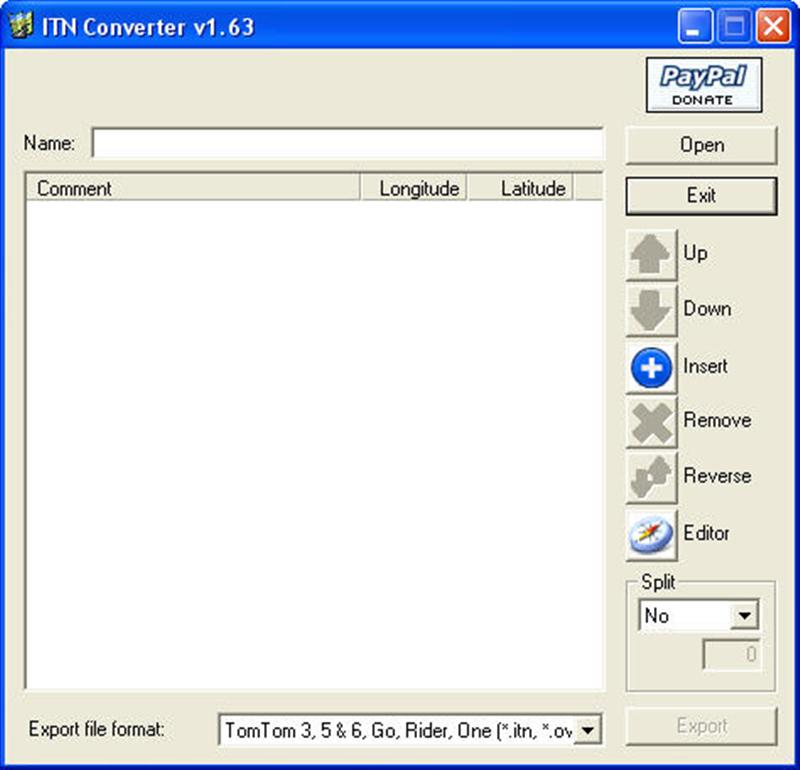
The interface for the ITN Converter POI software is fairly simplistic.
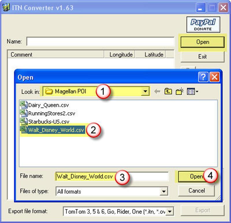
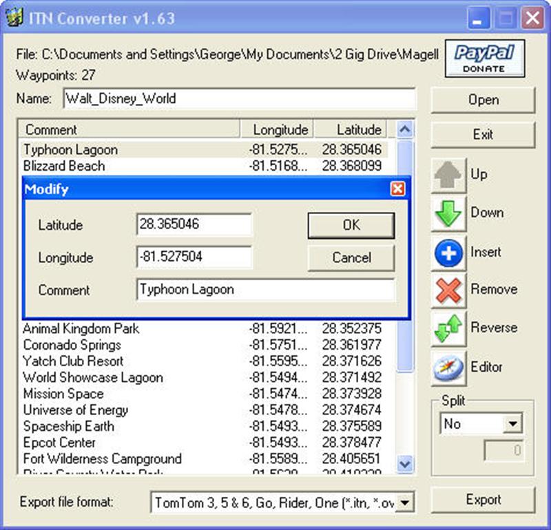
It may be easier, but not much, to start with an existing file. Open a downloaded .CSV file, or one that you have created. (1), (2), (3) and (4). That’s easy enough!
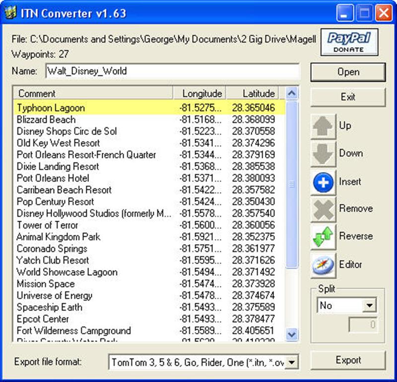
To change an existing entry just double click on it. About all you change here is the “Comment” unless you have a specific latitude and longitude you want to edit.
The fun begins when you open the editor (The little compass icon). It will read all the POI’s into the editor window. If you click on one of the points (8) it will take you to that spot on the map. You can edit the Comment by clicking on it in the “flag” (7). Remember to “Save” your changes, and the “Add to itinerary” to update it in the list.
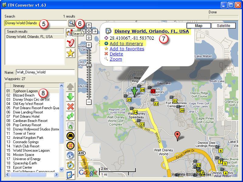
To create a new POI for your file. Open the “Editor” a new window opens using Google Maps. Enter the address, (5) if you know it, and click the “search” magnifying glass (6). It should take you to the location, or show some options if there is more than one possibility. I like to use the Satellite view so I can see details such as parking lots and drives that are not seen on a Street map. Zoom in until you can accurately place the “Pin” to get an exact reading. You can move the “Pin” by clicking and dragging it and it automatically changes the latitude and longitude of the location. The information box (7) will have generic title in it. Click on it and change it to read however you want. This will be the “Name” shown in the GPS so make it meaningful. NOTE: Remember to also click on the “Update” button next to the new name or it will revert when you save it. Finally click on the “Add to itinerary” option and it will add the point to the list of POI’s shown in (8). When you close the window it will add all the new selections to the original file. How sweet is that!
After you select all the points you want in your file (Hey you can come back and add more later – start with a few to make sure you like your results and then go back and add more…. and more…. and more…..
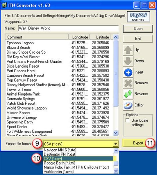
I found the order they are in does not seem to matter since the Magellan POI software will place them in alpha sequence anyway. If you have not done so, give it a name you like in the top “Name” window. Then once you are ready click on (9) to select the type of file you want to save this as, for my Magellan I must use the “.CSV” format (10). Finally click on the “Export” button (11) to save the file where you will be able to find it later!
Now go back to the Magellan POI software, open your new file and admire all your work…. or find a complete disaster! Okay admire your work for now, and I will go through how to make it look nice and add it to the GPS unit next time.
What’s that you say…? You don’t know what to do with the .CSV file, or how to get it into your Magellan device? Better come back in a week or two.
Until the final POI is no longer Pointedly Interesting,
George
UPDATE November 15,2008
After being so impressed with the ITNConv software, it has not worked for several days. Apparently it is run through the authors web site, and I am getting 404 errors when I try to use the editor. Hopefully this is a short lived issued.
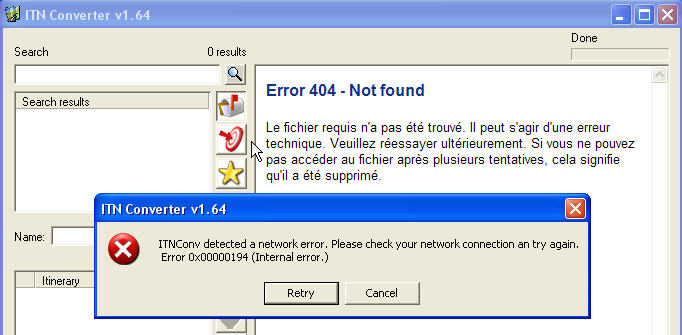
There are several forums listed where the author sometimes responds, but I have not seen any mention of this issue. Note that I have tried on three different computers, using two different networks with the same results.
can you repost the Magellan POI editor and reply with a link to download?
Wes try the link in the post above now.
Wes try the link in the post above now.
“http://www.kasdorf.name/Downloads/POI_Mgr.exe”