
Garmin Foot Pod Calibration 43

Garmin Foot Pod Calibration 37

Garmin Foot Pod Calibration 25

Garmin Foot Pod Calibration 34

Garmin Foot Pod Calibration 28

Garmin Foot Pod Calibration 13

Garmin Foot Pod Calibration 16
Garmin Foot Pod Calibration 43
Garmin Foot Pod Calibration 37
Garmin Foot Pod Calibration 25
Garmin Foot Pod Calibration 34
Garmin Foot Pod Calibration 28
Garmin Foot Pod Calibration 13
Garmin Foot Pod Calibration 16
The other day I went out for a walk, ended up following the new Geddes Road to Matthaei Botanical Gardens path. It is still under construction, so maybe not a real FKT, but I did go from the “Yard of Bricks” in front of the conservatory, to the sidewalk on Geddes Road. A little rough to follow in places though. Maybe try again in a few weeks to see how it is coming along. Really looking forward to this route for easy access to Gallup Park and all the rest of the B2B Trail.
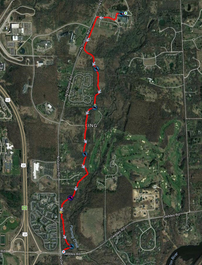
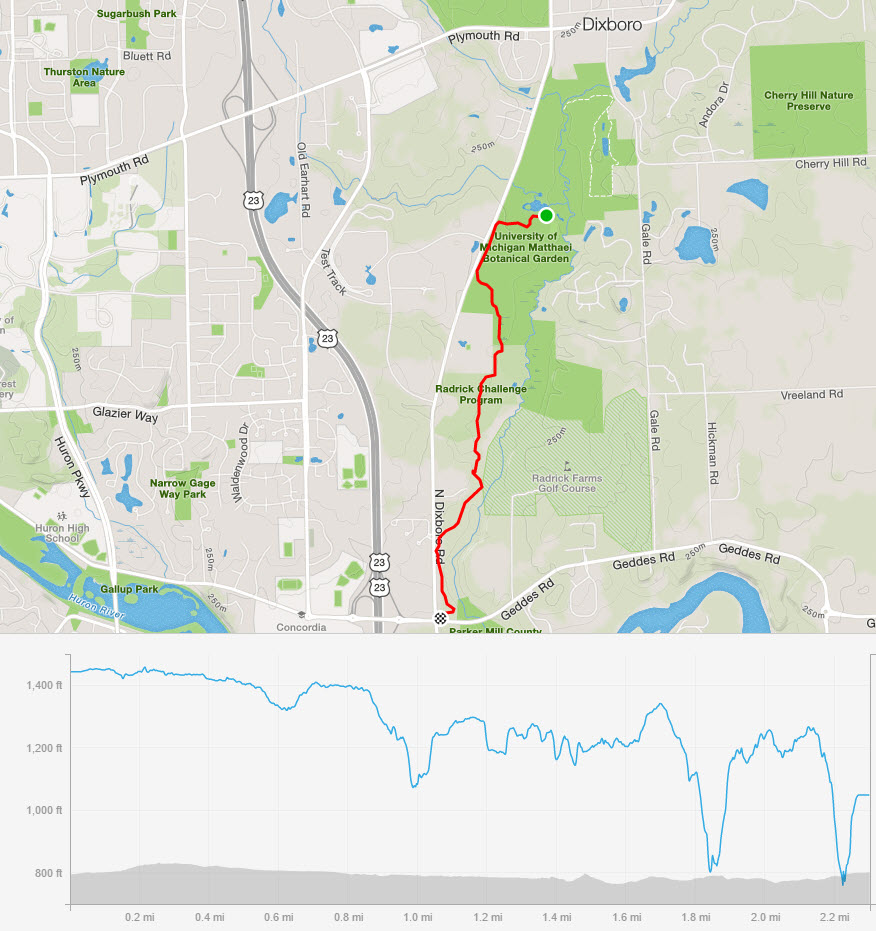
Some thoughts. Park at the mill, it’s free, the gardens charge for parking. The length looks to be about 2.3 miles. Overall it will be pretty flat, a few ups and downs closer to Geddes Road.
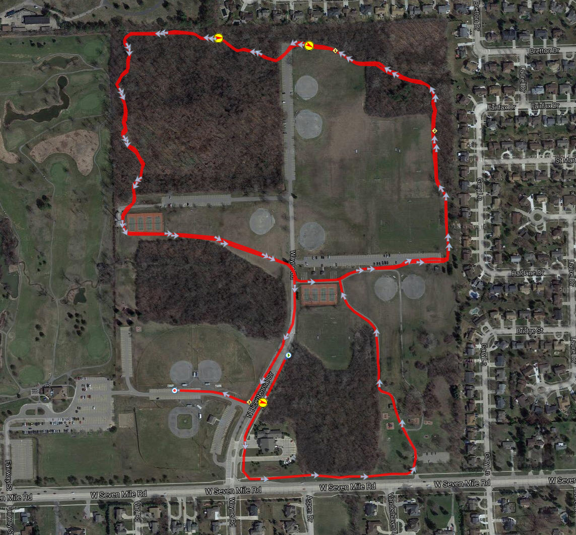
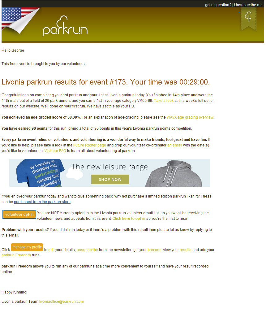
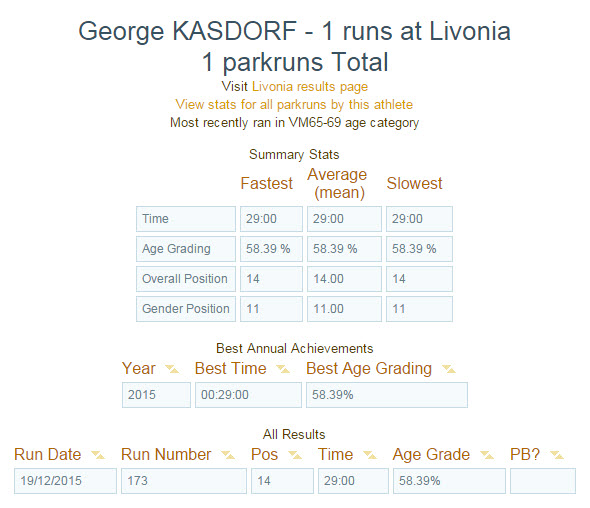
Today (Saturday December 19, 2015) I went for a run with the ParkRun group in Livonia Michigan. I recently heard about this group while talking with a person picking up his packet at another race. It sounded like fun so thought I would give it a try.
First I did some research at their web site. https://www.parkrun.us/livonia/
I signed up and printed out the bar code required to get a timed result.
When I woke up on Saturday morning it was only about 24 degrees out, so having previously decided to do this run was a good to make me get out and run, or I probably would have stayed under the warm blankets.
I made the short drive to Livonia where I saw the group assembling, parked and got out.
Made a few introductions and signed in. Followed the group over to the start line. Everyone was bouncing around trying to keep warm. Pretty soon we were all off and running.
(The following table contains only partial results. Visit the ParkRun web site to see everything!)
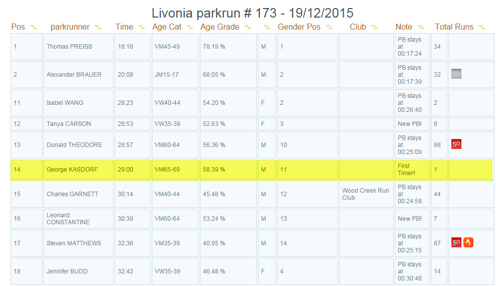
They keep track and after you complete a given number of runs you get the icon in your entry. (10 and 50 runs completed shown above)
Seems like a good way to help me get out and running on Saturday morning, especially on days like today where I would have a tendency to stay in and keep warm!
Merry Christmas!
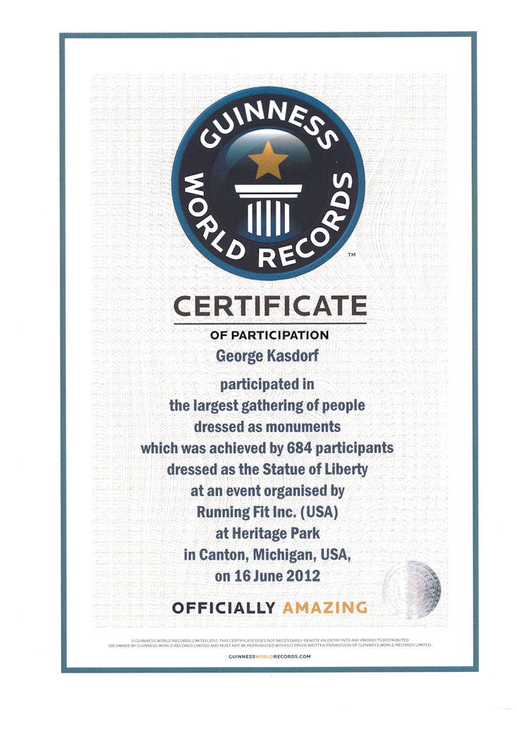
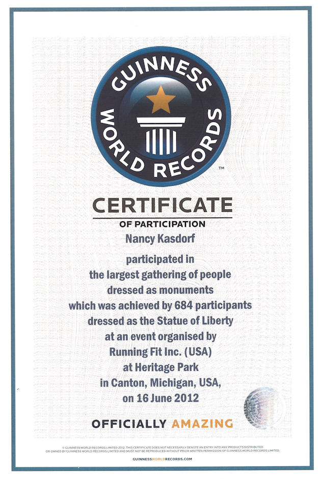
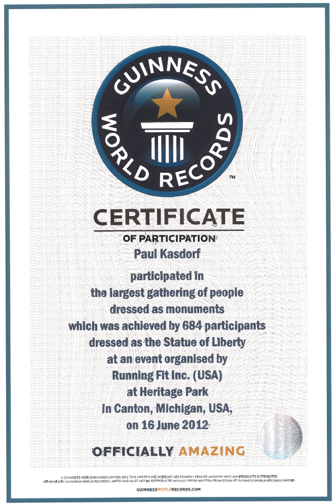
Well, not everyone who does their first official, timed, race breaks a world record, but the Kazology Team did just that!
Three runners, three miles, three world records!
Don’t think so? Well there is proof!
So, what was this for?
Well, back in June of 2012 the town of Canton Michigan sponsored the “Liberty Run”, a 5K (3.1 Miles) race.
These three highly trained and highly motivated sub-elite runners took up the challenge and blazed through the course in record time! Two of the three set PR’s for the 5K distance, and all three made it into the Guinness World Book of Records.
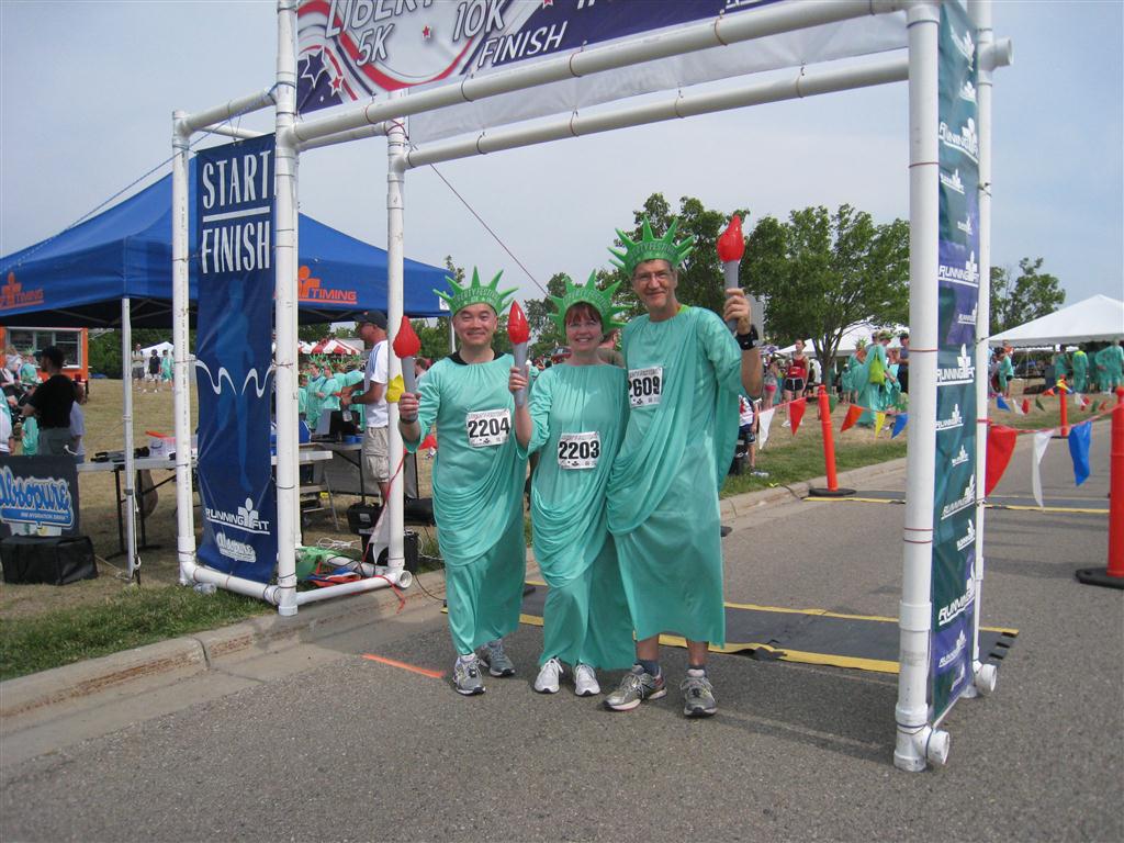
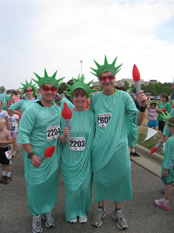
2012 Liberty Festival
Lots more pictures were taken and posted in the race photo page.
Been playing around with this, and found how to add an overlay.
Seems like it has a lot of possibilities, especially on known routes such as established races.
If you run with a GPS watch, you can probably make an overlay easily from the watch data. I did one below.
Save the file as a KML.
Add it to a directory on your web host.
Put the URL to the KML file in the Real Time Tracker set up “Custom Map Overlays”, like this.

Adding a KML file to Real Time Tracker
The go to the Map page, scroll around the map until you find where the run is.
You are ready to go. I need to get out and try this soon. I am hoping it will add a track right on top of the “planned course”. I see this as really useful when out of town running a race so others can watch the progress. Actually even if they are at the race, they can track on a smart phone to see right where I am at, like coming to an aid station, or nearing the finish line! Pretty cool!

A favorite trail run overlay KML.
The Scotiabank Toronto Waterfront Marathon route created as a KML file and added to Real Time Tracker.

The Scotiabank Toronto Waterfront Marathon overlay KML
I have been searching off and on for a way to let people know:
I tried a number of different ways, none seemed to be what I wanted.. there are programs that let you send the current location via email or SMS, but they did not do what I wanted. Some only have “fences” that can be programmed to let someone know when you get to a certain place, which is nice, but by the time I get to the end it is to late to let the person know.
Finally I came across “Real Time Tracker”, by Greenalp. This does what I have been looking for!
Check out the last, or current run!
![]()
This is particularly useful for runs when I am away from home so people can track if I am running or in a ditch. It can also be used during races to see where I am on the course… or pretending to run while I am sitting in a bar somewhere.
Recommended!
Until Real Time GPS is false,
George