Flat picture with Video Introduction using iPanorama.

This entry is part 7 of 9 in the series iPanorama

The above window uses “Shortcode” to put on post.

The following window uses iframe settings to display. Both use the exact same iPanorama tour.

<iframe width="780" height="555" src="https://www.kasdorf.name/wordpress/ipanorama/virtualtour/23" frameborder="0" allowfullscreen=""></iframe>

For fun, I saw the code to add a movie “Splash Screen” at the beginning of the tour. I need a better video to use though, I just grabbed the first one I came to!

Either way works, but using iframe allows you to easily adjust the size of your window.
Mantis Chipmate Info

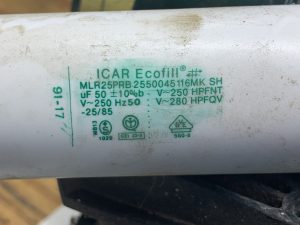
A question was asked about the capacitor to start the motor. I pulled the cover off mine, which wasn’t as easy as I thought.

There are only three small Phillips head screws, which normally would not be an issue. However the units are stored in an outdoor shed. Seems like the wasps like to find small holes to fill with mud to make “nests”. I had to loosen all the mud, then scratch around in the screw slots to get the mud out of them so the screwdriver would get down into them and actually grip enough to turn them! I did get them cleaned and removed.

Mantis Chipmate Capacitor info.

I took a few pictures of the capacitor and put everything back together.

Hope this helps!

Retrieving DJI Mini 2 Flight Record data.

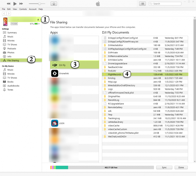
If you are thinking of adding flight telemetry to your drone videos, step one (after flying around somewhere) is to retrieve the Flight Logs. Not hard, but first time it may help to know where to look!

I use iPhone with iTunes on a PC, so everything here reflects that.

Plug your phone into the PC and open iTunes. It should connect and show the contents of the phone.

Look for “File Sharing” in the left hand pane. Select it. (2)

Then look for DJI Fly in the “Apps” section to the right.

In the list of documents, find “FlightRecords”

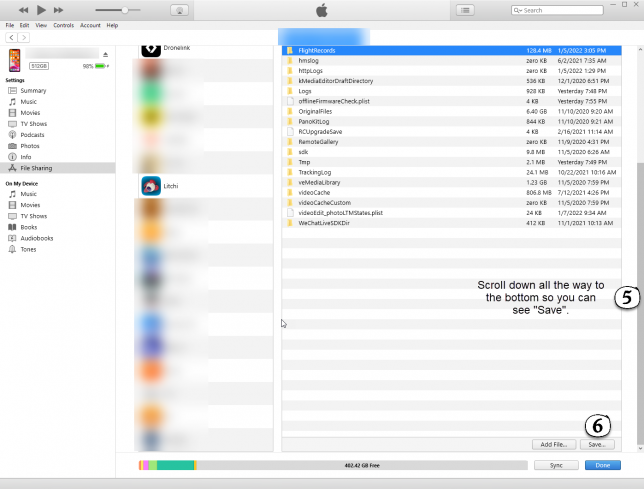
You may, or may not, have to scroll down the window. I do in order to see the “Save” button.

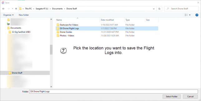
Make a note of the location where you save these file. Put them somewhere on your PC where you will be able to find them again!

Flat Picture Test

Initially there are no navigation icons (hotspots) showing, However, if you use the navigation arrows to go the the next “scene” if will show the missing icons.

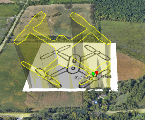
Drone Drawing

Playing with rotating flight plans 90° to do “Light Painting”

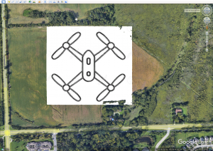
Started with simple image of drone.

Added it to Google Earth

Clicked around to make a path.

Exported as KML file, not KMZ.

Could have taken time to make a transparent PNG, but I didn’t. Works the same, unless you need to see ground to avoid obstacles.

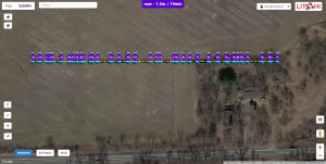
Imported into Litchi. Since all the points are stacked up vertically it just appears as a straight line.

Exported back to Google Earth just to see what it looks like now. You can see it stands up vertically now, not flat like a standard mission plan.